Illinois residents experienced a small 3.8 magnitude earthquake on Wednesday at around 3:59 AM (1:59 AM Pacific). It was centered about 3 miles south-southwest of Pingree Grove, IL and just 20 miles north-northwest of Aurora, IL.
The U.S. Geological Survey says Chicago residents may have felt the tremor. Chicago was just 30 miles east-southeast of the epicenter. The depth of the quake was 8.6 miles below the surface of the earth.
The fault which caused the quake has not been identified. It is believed to be “un-named”, so this may be a new one. Most identified fault lines are found west of the Rocky Mountains.
“Earthquakes everywhere occur on faults within bedrock, usually miles deep. Most of the region’s bedrock was formed as several generations of mountains rose and were eroded down again over the last billion or so years,” the report stated.
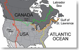
The known seismic zones east of the Rocky Mountains include the New Madrid zone centered on southeastern Missouri, the Saint Lawrence rift system, the Charlevoix-Kamouraska seismic zone of eastern Quebec (large quake in 1925). Earthquakes can also occur in New York, Philadelphia, and along the Wilmington urban corridor.
Source:digitalnewsreportSubscribe for more updates

No comments:
Post a Comment